
The National Weather Service is warning of treacherous surf and rip currents at the shore.
Shore communities and the National Weather Service are warning of dangerously rough surf conditions and rip currents as Hurricane Erin churns up the East Coast – although the storm itself is expected to remain hundreds of miles out to sea.
Cape May, Wildwood, Longport, Margate and Ventnor were among the first shore towns to announce that they will ban swimming. Other shore communities are expected to follow with swimming bans or restrictions. Atlantic City is allowing bathers in only knee-deep water.
“This is not a decision that we have come to lightly, but our priority is the safety of our beachgoers and lifeguards,” the Margate Beach Patrol said of the swimming ban in a social media post.
The city of Wildwood and Wildwood Beach Patrol warned that the surf conditions will become “extremely dangerous” while emphasizing the need for a swimming ban in the next few days.
Wildwood also will not endanger the lives of the lifeguards by putting them on duty, Commissioner of Public Safety Steve Mikulski said.
“No lifeguards. No swimming. It’s that simple. When individuals ignore safety precautions and enter the water, our first responders are forced to put themselves at risk. The Wildwood Beach Patrol, Fire Department, and Police Department work tirelessly to protect this community, and we must not endanger them needlessly,” Mikulski said in a news release.
The Wildwood Beach Patrol will continue to issue surf advisories, which can be found on the Beach Patrol’s Facebook page, the city of Wildwood’s Facebook page, and the city’s X account.
“Through the remainder of this week, the Wildwood Beach Patrol advises that beachgoers do not enter the water for the safety of themselves and first responders,” Wildwood Beach Patrol Capt. Ed Schneider said.
Ocean City urged beachgoers never to swim at a beach that doesn’t have lifeguard protection. Noting that dangerous surf conditions will build throughout the week, Ocean City said in a statement that its Beach Patrol will “likely issue swimming restrictions of varying degrees.”
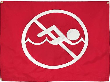 Some shore towns are banning swimming during the rough surf conditions.
The hurricane will generate a high risk of rip currents through Wednesday evening and rough surf conditions from 6 a.m. Wednesday to 6 a.m. Friday, according to the forecast.
“Rip currents can sweep even the best swimmers away from shore into deeper water,” the city of Cape May said in weather alert.
Large, breaking waves from 6 to 9 feet high are expected in the surf zone on Wednesday and between 7 and 11 feet high on Thursday, according to the weather alert.
The National Weather Service office in Mount Holly, N.J., warned of “life-threatening surf and rip currents” along the Jersey Shore beaches as the hurricane tracks up the East Coast. Strong northeast winds are also possible Thursday and Friday.
Echoing the warnings of the shore towns, the weather service is telling beachgoers to stay out of the ocean and heed the advice of lifeguards.
“Breaking waves will significantly increase in the surf zone this week along the Jersey Shore and Delaware beaches. These combined with prolonged onshore wind and long period swells from distant Hurricane Erin will result in dangerous surf conditions, including a high risk of dangerous rip currents,” the weather service said in a statement.
Adding to the weather woes, a coastal flood watch has been issued for the Cape May County shore communities from Tuesday afternoon to 11 p.m. Friday.
Steady northeast winds will continue to push water into the back bays and cause minor coastal flooding, according to the forecast.
“For your safety and the protection of your vehicle and neighboring properties, never drive on any street covered by water. Please do not disregard barricades on flooded streets,” Ocean City said in a statement.


