
The threat of serious flooding is concentrated in the bayside and oceanfront communities. (Courtesy of National Weather Service)
The shore communities are bracing for the triple threat of serious flooding, strong winds and treacherous surf conditions as Hurricane Erin pounds the coast – even though the center of the storm remains hundreds of miles offshore.
The greatest impacts from coastal flooding are expected during Thursday evening's high tide. Locally, major flooding is possible in the Cape May County shore towns, according to the National Weather Service.
“Numerous roads may be closed. Low lying property including homes, businesses, and some critical infrastructure will be inundated,” the city of Cape May said in a weather alert.
Other major impacts expected from the storm include beach erosion as the heavy surf pounds the shoreline in the bayside and oceanfront communities of Cape May County.
At 2 p.m., Gov. Phil Murphy declared a State of Emergency for all 21 New Jersey counties to prepare for the storm. The governor cited the danger from flooding, rough surf and high winds.
“Over the past couple of days, we have seen the effects of Hurricane Erin along the Jersey Shore in the form of dangerous rip tides. Today and tomorrow will be no exception,” Murphy said in a statement. “As the storm moves past New Jersey over the next 24 hours, we are expecting high surf and rip currents, coastal and flash flooding, and a high erosion risk in parts of the state. We ask all New Jerseyans to monitor local weather forecasts and warnings and stay informed on evacuation protocols, especially if you’re down the Shore.”
Dangerous surf conditions and the risk of strong rip currents were keeping bathers out of the water. Shore towns in Atlantic and Cape May counties have imposed an outright swimming ban or are restricting bathers to ankle-deep water.
The National Weather Service has issued a Coastal Flooding Warning until 2 a.m. Saturday. The forecast calls for the highest tide levels that Ocean City and Strathmere have seen in three years. Water levels are expected to crest in Ocean City in the hours around high tide at 7:50 p.m. Thursday.
“We’ve seen rough seas from strong northeast winds all week, and the waves will only get bigger and stronger as the storm approaches and passes by New Jersey on Thursday,” Ocean City Mayor Jay Gillian said in a statement.
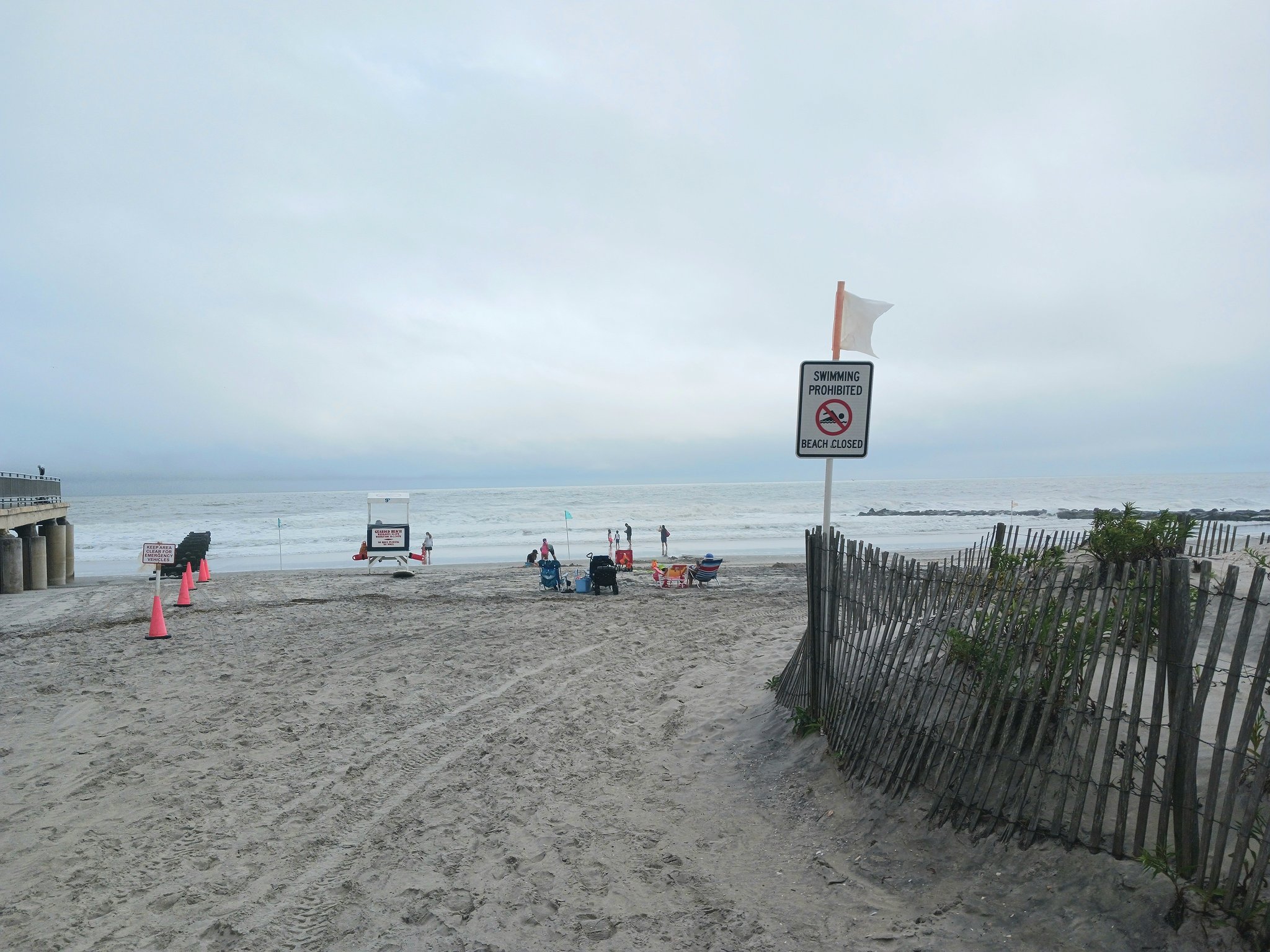 A "Swimming Prohibited" sign is posted at the entrance to the Ninth Street beach in Ocean City.
In Ocean City, a City Council meeting is scheduled for 6 p.m. in City Hall. Council is expected to take a vote that represents a critical first step in the future development of the former Wonderland Pier amusement park on the Boardwalk.
Council will consider a resolution asking the city’s planning board whether to recommend the Wonderland site “in need of rehabilitation.”
Developer Eustace Mita, who owns the Wonderland property, is asking the city to declare the site in need of rehabilitation to speed up plans for his proposed $150 million luxury resort hotel in place of the amusement park.
Council Vice President Pete Madden confirmed shortly before 2 p.m. that the meeting is still on, despite the bad weather.
Meanwhile, as of Thursday morning, the center of Hurricane Erin was estimated to be around 400 miles southeast of Cape May as the storm churned up the East Coast on a path that is eventually expected to take it away from land.
“The center of Hurricane Erin will pass well to our southeast and east today, but it has a large wind field which will result in impacts locally,” the Cape May County Office of Emergency Management said in a statement.
Sustained winds are estimated at 25 to 35 mph, with gusts up to 50 mph, hitting tropical storm-like ferocity.
Widespread minor to moderate coastal flooding is in the forecast for the high-tide cycles through Friday evening along coastal New Jersey and Delaware, the Delaware Bay, and the tidal Delaware River. However, major coastal flooding is expected in Cape May County.
Ocean waves are expected to build to 10 to 17 feet high through Thursday night, creating “very dangerous conditions” for mariners, the Cape May County Office of Emergency Management said.
For the latest official forecast information, visit the National Hurricane Center at www.nhc.noaa.gov or the National Weather Service, Mount Holly, N.J., at www.weather.gov/phi.


